FR EN
GERPHO
3D
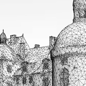
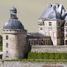
Gerpho offers 3D photos (whether aerial or not) : 3D colour digital models of sites, monuments or objects with dimensions ranging from a couple of centimeters to several kilometers. These 3D modes are very accurate, highly realistic and can be used in different ways : interactive visits either with specific viewers or on line, generation of videos or still photos from points of views that cannot be accessed any other way, dimensional measurements (length, surface volume) , and even creation of solid 3D models with 3D printers. They also allow urban or architectural projects which have been 3D-modeled with classical CAD softwares to be inserted into the 3D lanscape.

3D photo in figures

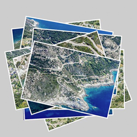
  • Initial shooting : 10 to 5000 high resolution photos
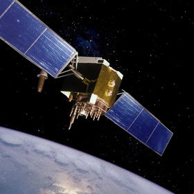
  • Aerial shooting : from a plane (500 to 3000 ft), an helicopter or a drone
  • Ground shooting : on foot, on an motorised platform, or with a pole
  • Computing time : 3 hours to 3 weeks
  • 3D model resolution : 0.1 mm to 50 cm
  • Covered area : a few square centimeter to several square kilometers
  • Number of vertices : 50.000 to several millions
  • Absolute dimensional accuracy : depending on resolution

Steps of a 3D photo reconstruction
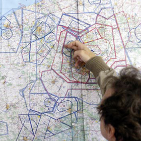
Project preparation

This phase is essential to project’s success. When shooting from a plane this includes defining : height of flight, flight route which takes into account terrain configuration and regulations, shooting parameters (focal length, pixel resolution, pixel count….)

Shooting process

The photos used to generate the 3D aerial model are most oftent shot from a small plane, such as a Cessna, or some times from a helicopter. Other aerial vehicles (drones, zepelins …), exhibit at present various limitations, which make them less suited to high quality, high area 3D photography

Post-processing :

It is an important step in 3D photo reconstruction : during post processing, constrast colour, and sharpness are adjusted so that the photos are best fit for the reconstrution process. During this phase, atmospheric haze is also removed, and finally, photos are adjusted with respect to one another to ensure a perfect homogeneity of the batch of photos, before starting the actual reconstruction process.

Georeferencing :

When shooting an aerial 3D photo, georeferencing can be obtained from the GPS data included in the EXIF metadata of the photos when a GPS is connected to the camera. One can also use a few ground measured data points. Once the 3D photo is georeferenced, one can easily compare successive 3D shots to measure the evolution of a given site, or include CAD generated projects.

Aerotriangulation :

Once all the above data is ready, it is fed into the « ContextCapture » software. This software detects « tie points » visible on two or more photos, and pairs these photos. From then on, trigonometric calculation on these tie points leads to the construction of a skeleton of the 3D model, and finally to the detailed (and georeferenced, if georeferencing data is available ) mesh.

Texturing :

The final texturing operation fills this mesh with the colours and lighting extracted from the set of input photos. The 3D model is now ready, with a highly realistic rendering. This model is compatible with usual 3D CAD softwares.
GERPHO3D photos 3D
© 2023 Gerpho3D - - Mentions légales