Case studies
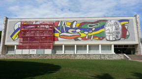
Façade of the Fernand Leger Museum in Biot (south of France)
This museum was built in 1960 in Biot, where the artist spent the end of his life. The south façade is covered with a pair of huge high relief sculptures (400 square meters). These sculpture are composed of black and white ceramic tiles within an abstract colour mosaïc background.
These square ceramic tiles, each measuring more than 40cm, have been exposed to strong
temperature changes, which have induced many cracks, and in several placed complete tiles or large
parts have fell from the sculpture. The French company SOCRA was selected to restore this work.
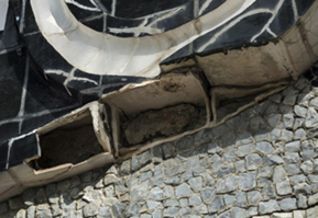
This implied to saw all the tiles to remove them, an,d restore most of them,and replace the most
damaged. However before dismantling the high relief, it was necessary to perform a complete
survey to gather all the information necessary to the reconstruction of the work to its original state.
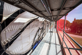
Socra asked gerpho to perform 3D photo to scale of the high relief’s. For technical reasons, the
sculpture could only be shot from a scaffolding installed in front and close to the work. Because of
this, it wasn't possible to view the sculptures as a whole, but only partial views shot from a
maximum distance of one meter on the successive floors of the scaffolding. Nevertheless, the 3D
software perfectly reconstructed the complete sculptures, without these shooting constraints being
visible on the final result. This 3D view was not only used by Socra to reconstruct the high relief,
but also by the museum in a public exhibition describing the restoration process.
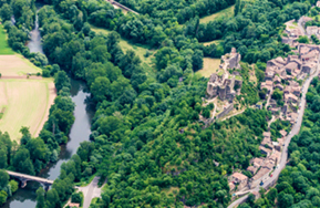
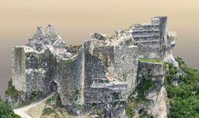
Château de Penne
This chateau is located on a rocky spur which overlooks trhe Aveyron river 200m lower. Architect
Axel Letelleir bought this chateau in year 2000 to restore what was at that time a ruin. To do so, it
was necessary to perform a topographic survey of the site. The French land survey company
Sompayrac was in charge of this difficult operation : although the top platform was easy to measure
using traditional methods, the outer façades were much more difficult to measure : some places
were visible only visible from placed located more than 100m lower, or from the air. Therefore
Sompayac asked Gerpho to perform a 3D survey of the chateau.
Very high accuracy was required (3cm) for this survey, and it was moreover required that this aerial
model would fit to the survey of the upper platform measured by Sompayrac with a 3D laser
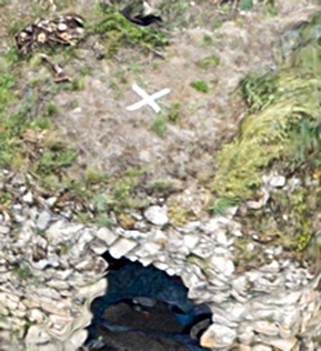
scanner. Therefor, Sompayrac placed several targets (7), which could easily be identified on the
aerial photos. These targets were georeferenced with a 1cm accuray. Gerpho performed the aerial
shooting with a 1cm resolution, which required overflying the chateau at a low altitude of 500ft, and
the use of a 200mm telephoto lens.
The georeferencing data of the targets were fed into the ContextCapture software, during the 3D
reconstruction of the chateau. Once the reconstruction performed the resulting model was compared
to the results of the laser scanned model This comparison showed that the required accuracy was
met by the aerial 3D scan in all locations where both methods had been able to measure.
This operation constitutes an experimental confirmation of the level of absolute accuracy which can
be reached with aerial 3D photogrametric survey using ContextCapture. These results were sent to
Acute3D/Bentley and were judged significant enough to be published by Bentley.